Type
Software as a Service (SaaS)
Collaboration
No
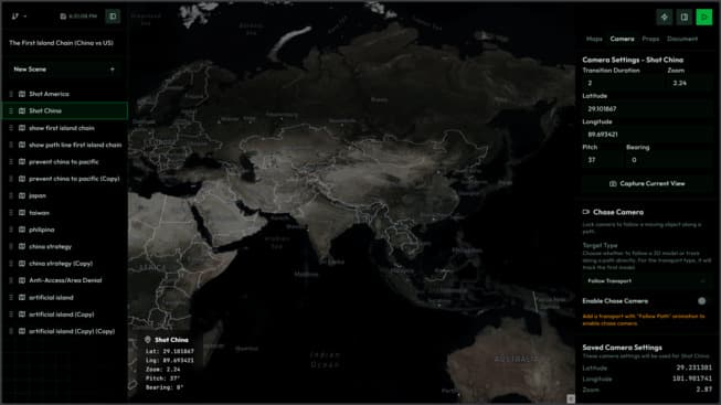
GeoBrief
An interactive, map-based presentation platform engineered for real-time terrain planning and tactical visualization, featuring a high-performance, dark-themed military tech interface.
The Challenge
Traditional presentation tools lack dynamic geospatial capabilities, making it difficult to visualize complex, multi-unit movements and terrain coordination. The system required a highly responsive SaaS architecture capable of rendering intense spatial data and smooth object animations simultaneously without compromising frame rates.
My Solution & Technical Strategy
I architected the platform from the ground up, balancing high-speed backend data processing with fluid frontend map rendering:
- SaaS Architecture & Real-Time Rendering: Designed a multi-tenant scalable infrastructure ensuring fast data sync. Combined Mapbox GL JS with Framer Motion to handle real-time rendering of complex spatial datasets seamlessly.
- Rich Tactical Interface: Developed an interactive HUD-style dashboard equipped with custom map layers, military tactical icons, dynamic callout components, pathlines, and defined operational zones.
- Interactive Unit Movement: Engineered the physics and animation logic for unit transport movements along designated paths, allowing users to simulate deployments intuitively.
- High-Performance Backend: Built and integrated robust API services using Golang, leveraging its concurrency model to ensure low-latency geospatial data processing and seamless system scalability.
Outcome
Successfully delivered a rugged, enterprise-grade tactical briefing platform. The system effortlessly handles real-time spatial updates and multi-unit movement tracking with sub-second latency, providing an immersive, lag-free experience for complex terrain visualization.
Tech Stack